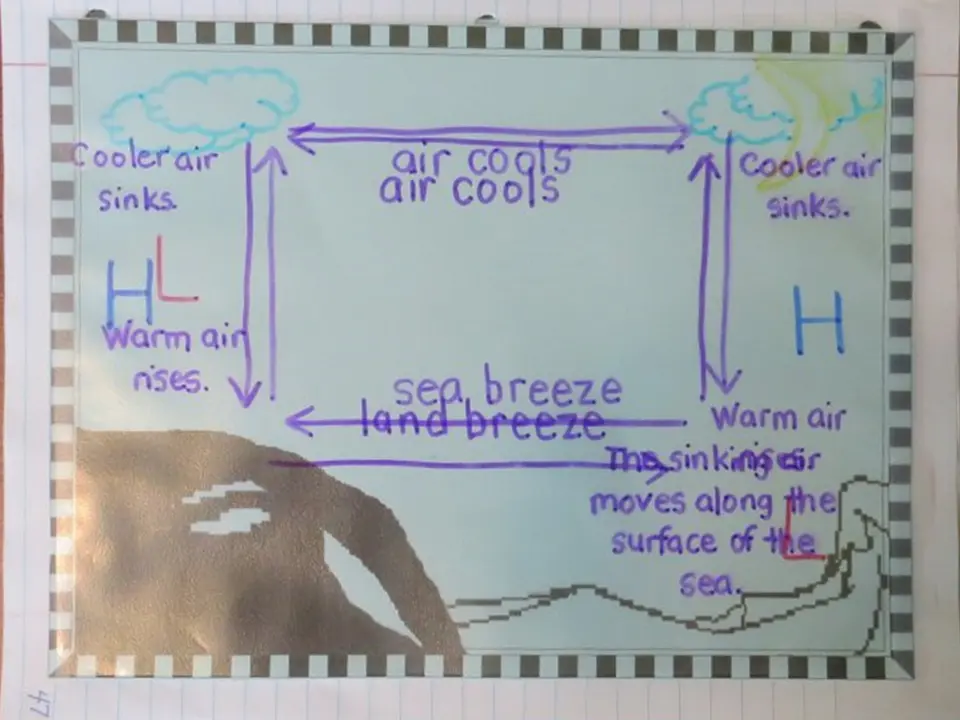
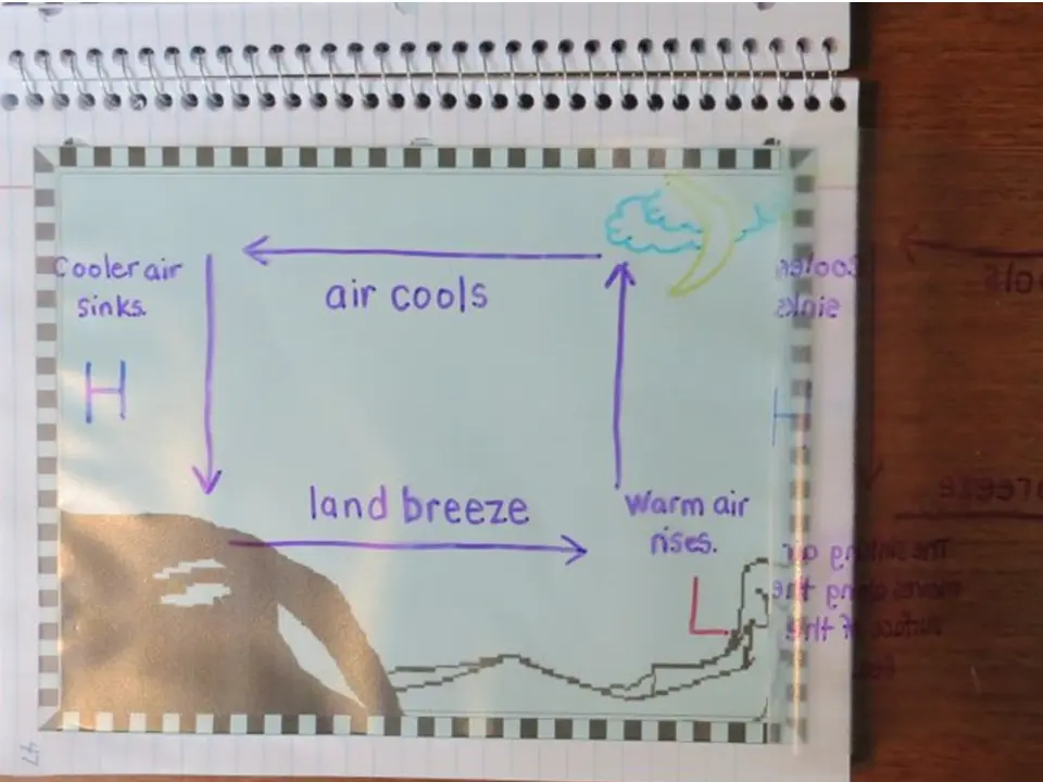
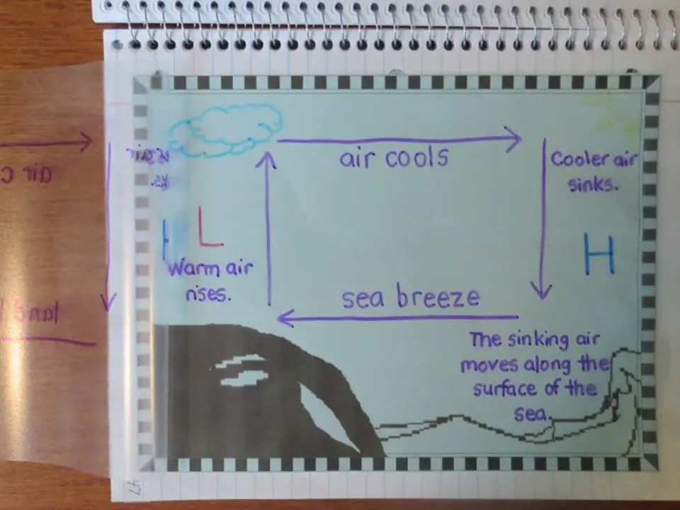
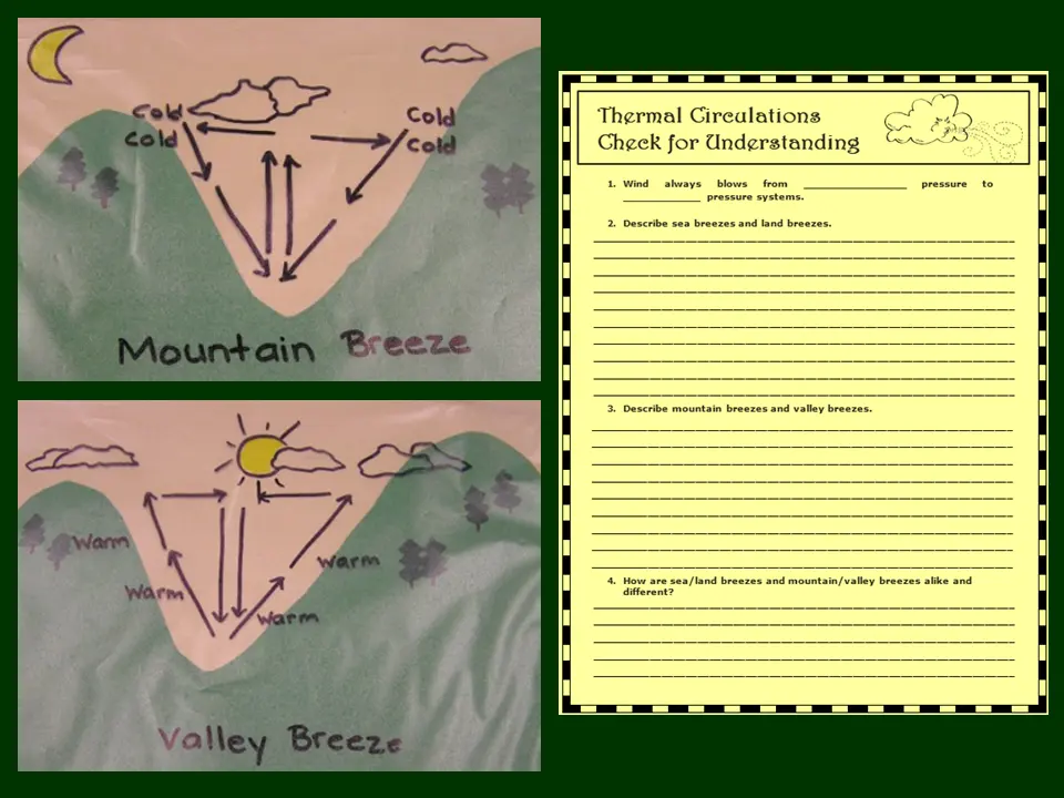
Local wind patterns — sea breezes, land breezes, mountain breezes, valley breezes — are the small-scale version of the same pressure-driven airflow that drives global weather. Mountains add another layer, creating dramatic wet-dry contrasts on opposite sides of the same ridge.
Land and water heat and cool at very different rates. Land heats quickly during the day and cools quickly at night — water changes temperature slowly. This daily temperature difference drives a wind cycle that reverses direction between day and night.
This organizer uses a unique construction technique — students trace arrow patterns onto clear page protectors, then staple one panel on each side of a printed background. Lifting each panel independently shows the airflow for each breeze type without the confusion of overlapping arrows.
Mountain and valley breezes follow the same logic as sea and land breezes — just applied to elevation instead of water. Valley air heats during the day and rises up the mountain slope; at night the mountain air cools and sinks back into the valley.
The valley and mountain breeze organizer uses the same page protector overlay construction as the sea and land breeze organizer. One plastic panel shows valley breeze airflow (day), the other shows mountain breeze airflow (night). Students lift each panel over the shared mountain background to compare the two patterns — the reversal of direction is immediately visible without any overlapping arrows to confuse the picture.
When air is forced upward — by a mountain, a front, or a convergence zone — it cools and its moisture condenses into precipitation. The type of lifting determines the type of storm. On the far side of a mountain, the now-dry air descends and warms, creating a rain shadow.
The rain shadow unit closes with three activities — an example atmospheric lifting poster, a written organizer, and a 3D physical model that brings the entire concept off the page and into students' hands.
Covers the three types of atmospheric lifting — geographic, frontal, and convectional — with diagrams showing how each forces air upward and triggers precipitation.
A culminating Check for Understanding page covers sea/land breezes and mountain/valley breezes together — asking students to explain both cycles and compare their causes.
Explains how mountains create dramatically different climates on each side — the wet windward slope and the dry leeward rain shadow — with a real-world example.
Students build a physical three-dimensional model of the rain shadow effect — the centerpiece of the unit and a natural culminating activity that connects atmospheric lifting, precipitation, and climate patterns in one hands-on project.
This page is one part of a full NGSS-aligned unit covering the hydrologic cycle, atmospheric layers, air pressure, fronts, storms, humidity, temperature, climate patterns, and more — with hands-on experiments, foldable organizers, vocabulary tools, and Check for Understanding pages throughout.
View the Full Unit on TPT