Earth's atmosphere is a layered system — each layer has distinct properties, and the pressure differences between regions within those layers are what set air in motion as wind. Understanding this sequence from layer to pressure to wind is the foundation for reading weather maps.
The atmosphere is divided into five distinct layers based on how temperature changes with altitude. Each layer has unique characteristics — from the weather-filled troposphere at the bottom to the near-vacuum of the exosphere at the top.
A staggered flip organizer and a hand mnemonic for atmospheric composition help students remember the five layers and their properties, while a Check for Understanding page assesses comprehension of both atmospheric structure and the ozone layer.
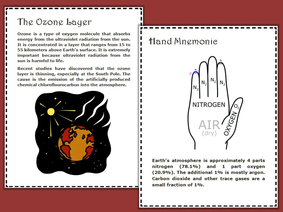
Teaching posters cover the ozone layer in detail, including its role in absorbing UV radiation, its altitude in the stratosphere, and the causes and effects of ozone depletion.
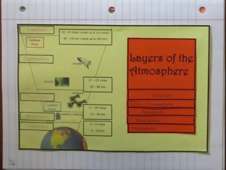
A staggered flip organizer gives each atmospheric layer its own labeled flap — students open each flap in order from the ground up, recording altitude, temperature pattern, and key facts.
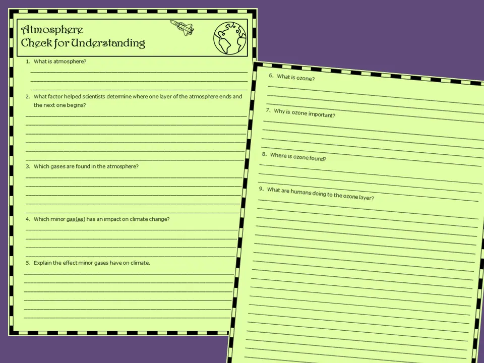
Structured questions assess student understanding of all five atmospheric layers, the composition of each, and the role of the ozone layer in protecting Earth's surface.
Air pressure is the weight of the air above pressing down on a surface. Where air is dense and heavy it creates high pressure; where it is thin and light it creates low pressure. Wind is simply air moving from high pressure toward low pressure.
Three activities take students from understanding what air pressure is to measuring it themselves — covering isobars, a pamphlet fold organizer, and a hands-on barometer experiment.
A reference poster explains high and low pressure systems, how air molecules create pressure, and why humans can only survive within a narrow pressure range.
A three-panel pamphlet organizer covers air pressure concepts, isobars, and the relationship between pressure and wind — with space for student notes and diagrams.
Students build a simple barometer using household materials and track air pressure changes over several days, connecting their readings to observed weather conditions.
A three-flap flip organizer covers high pressure, low pressure, and isobars together, while a separate wind booklet goes deeper into pressure gradient force, the Coriolis effect, and how converging winds create the patterns seen on weather maps.
Because Earth rotates, winds don't travel in straight lines — they curve. In the Northern Hemisphere winds curve to the right; in the Southern Hemisphere they curve to the left. This is why hurricanes rotate counterclockwise in the north and clockwise in the south. The wind booklet covers this concept with diagrams showing how pressure gradient force, Coriolis force, and friction combine to determine actual wind direction and speed.
This page is one part of a full NGSS-aligned unit covering the hydrologic cycle, atmospheric layers, air pressure, fronts, storms, humidity, temperature, climate patterns, and more — with hands-on experiments, foldable organizers, vocabulary tools, and Check for Understanding pages throughout.
View the Full Unit on TPT